About
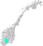
Gea Norvegica Geopark is Scandinavia’s first UNESCO recognized geopark. The geopark’s purpose is to spread knowledge about our geological inheritance as well as the connections between geological processes and our human existence. Visit our website for more information!
The geologically unique area we call Fensfeltet is located in the Nome municipality southeast of Ulefos. 580 million years ago there was very unusual volcanic activity here. Today most of the volcano has been worn away, but we still find remnants of the volcano’s magma conduit as well as other traces of volcanic activity in the area, such as near Kragerø.
The continent “Baltica”, of which Norway was a part, was at that time low and flat and is now known by geologists as “the sub-Cambrian peneplain.” This level country is can still be found in many places in Norway, such as on the Hardangervidda. But like so many times throughout the earth’s history, conditions changed and the ocean flooded the flat landscape, which happened in conjunction with movement under the earth’s surface at one of Baltica’s collision zones. Rises in temperature caused the crust to melt around where Ulefos is today, perhaps in conjunction with a so-called hot spot, and the Fen volcano was the result.
But what is so special about this volcano? Well, the rocks we find today are very atypical for a volcano. Already in 1921, one of Norway’s famous geologists, W.C. Brøgger, asserted the volcanic origins of limestone found at Ulefoss. He named the rocks carbonatites but didn’t have a large audience for his theory since everyone knew that limestone is sedimentary and not igneous. Volcanic rocks are typically basalt or porphyry, for example. It wasn’t until 1960 that an English geologist was able to prove the existence of lime-containing lava coming from active volcanoes in the African rift. In other words, Brøgger was right after all. The rocks he described from Nome he named after farms in the area, such as søvitt, melteigitt, vipetoitt, fenitt, and rauhaugitt. Damkjernitt is named after Damtjern (Brøgger spelled it incorrectly). All rocks have been accurately and precisely described and Fensfeltet has become an important reference point for volcanic limestone. Carbonatites are still today a geological word for this group of rock. Carbonatites on Fen have magmatic origin (i.e. they originate as a molten mass). Damkjernitt has been raised to the surface from deep underground through volcanic explosions. Molten carbonatites pushed through the older mountainous rocks and the result was rock containing mixtures of alkali feldspar, sodium rich amphibole, nepheline, aegirine, and phlogopite. Other minerals also occur, such as titanite and apatite. Volcanic activity led to breaks in the earth’s crust and in these breaks flowed warm watey solutions.
These processes led to the oxidation of iron, such as is found in carbonatites, and this led to the red color of rocks containing iron. The red color has been named “redrock,” and it is redrock which was mined in the 1650s. The iron from Fen was then sent to the Ulefos Ironworks. There are even more chemically unusual qualities in carbonatites. After WWII, the rare metal niobium was mined, and the presence of thorium also made Fensfeltet well-known in Norway.
Gea Norvegica Geopark is an intermunicipal company which is owned by the municipalities of Bamble, Kragerø, Lardal, Larvik, Nome, Porsgrunn, Siljan, and Skein in addition to the Telemark and Vestfold counties. The Board is the top authority and is comprised of 12 elected members, one from each municipality and two from each county.
TripAdvisor


